The purpose of this application is to change the zoning of the subject lands from Light Industrial (LI) in the 2140 (97) Zoning By-law to Single Detached (R1D), Townhouse (R3B), Private Street Development (R3D), Open Space – Parks and Recreation (OS1), Environmental Protection 2 (EP2), and Utility (U), subject to site-specific standards; and from Future Development (FD), Open Space Conservation (OS2) and Environmental Protection Two (EP2) in Zoning By-law 60(2019) to Single Detached (R1D), Townhouse (R3B), Private Street Development (R3D), Open Space – Parks and Recreation (OS1), Environmental Protection 2 (EP2), and Utility (U), subject to site-specific standards.
This is to facilitate the continuation of the build out of the Rolling Meadows Secondary Plan area, providing for residential dwelling units and community and open space uses.
Submission 1 Supporting Documents:
- Planning Rationale
- Demonstration Plan
- Draft Plan of Subdivision
- Environmental Impact Study
- Functional Servicing and Stormwater Management Report
- Land Use Compatibility Study
- Preliminary Phasing Plan
- Stage 1 Archeological Assessment
- Stage 2 Archeological Assessment
- Transportation Impact Study
Submission 2: In response to city and agency comments, the draft plan of subdivision was revised to include a 2.35-hectare stormwater management pond block, and a mid-rise development block along Upper’s Lane (the “revised proposal”). Due to the additions of these blocks, the revised proposal contemplates a total of 728 units, resulting in a net density of 32.1 units per net hectare. The revised proposal continues to provide 7 low-rise residential development blocks that will be designed through future site plan control applications, along with three new public streets, a public park block, and protected natural heritage area.
Submission 2 Supporting Documents
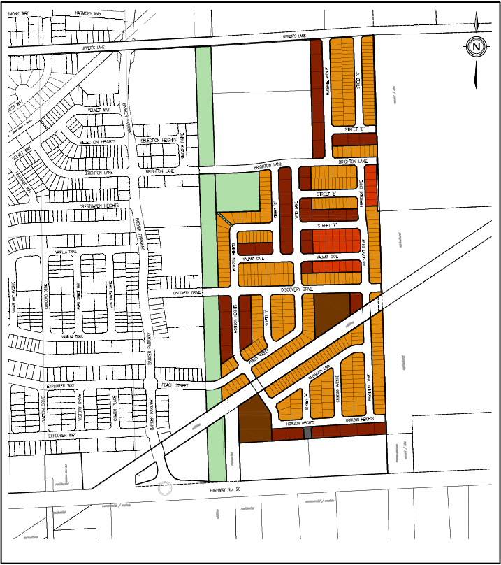
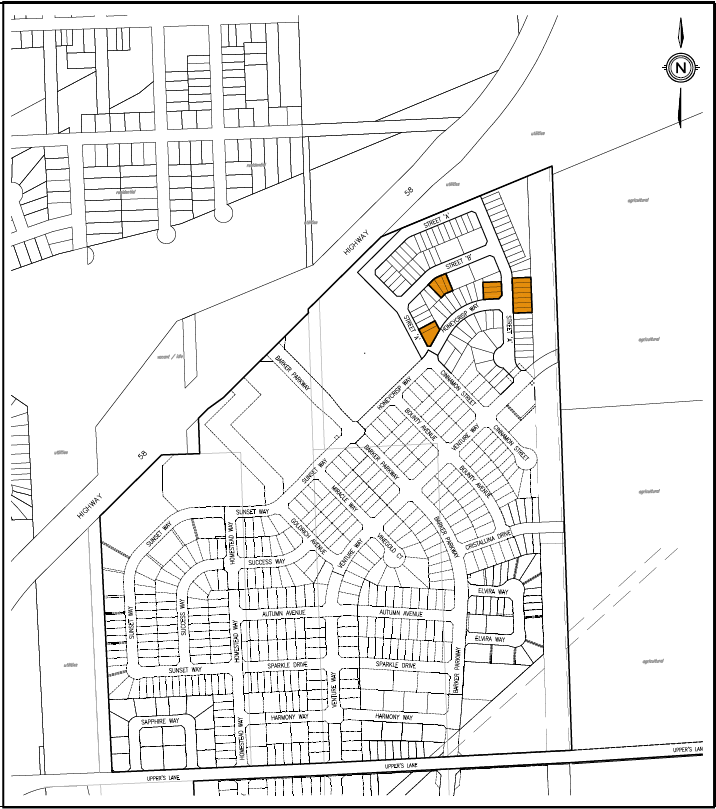
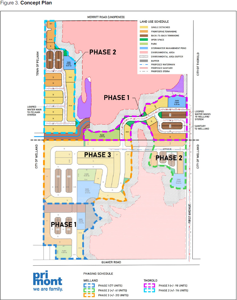
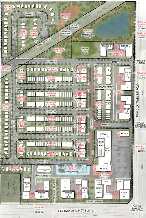 Image taken from Updated Rendered Master Plan